Azure Map in Power BI with Layers: Part Three

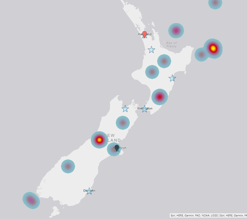
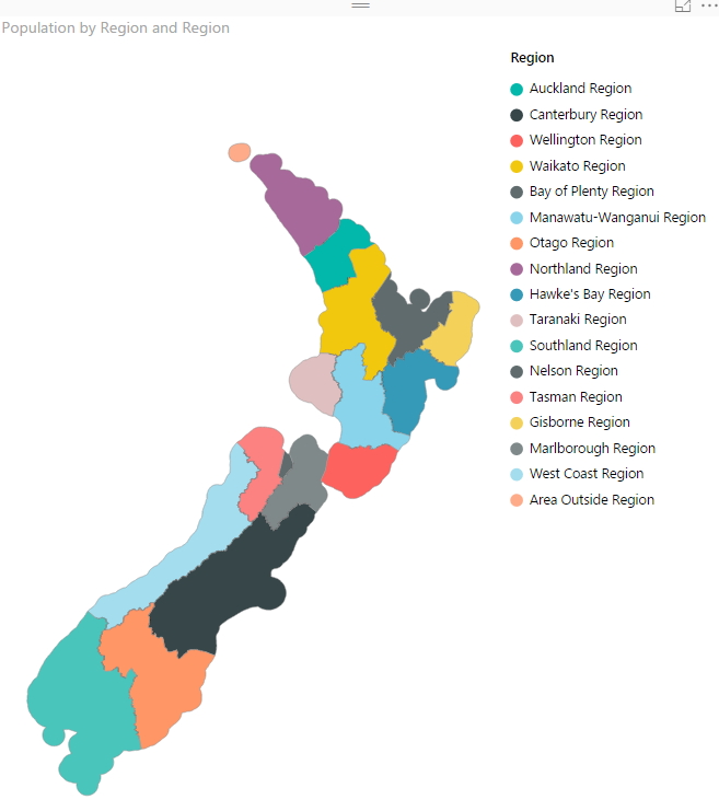
In the last two posts, I have explained how to access Azure Map and create bubble charts and Bar charts with other available settings. check the first Post from here and the second one from here. In this blog, I am going to talk about different layers we can have on top of the map. Read more about Azure Map in Power BI with Layers: Part Three[…]

Azure Map in Power BI: Part Two

In the last post, an introduction to Azure Map was presented. Azure Map has considerations and limitations as below( that may resolve later as now is in preview) You can use it in Power BI Desktop, Power BI Service, and mobile application But, not available Power BI publish to the web, Embedded and service embedding. Read more about Azure Map in Power BI: Part Two[…]

What is Azure Map in Power BI: Part One

Reza rad already wrote some articles about Map visuals in Power BI such as ArcGIS, Shape Map, and Filled Map. In this blog post, I am going to talk about Azure Map Visual in Power BI. a definition from Microsoft website: “The Azure Maps visual for Power BI provides a rich set of data visualizations Read more about What is Azure Map in Power BI: Part One[…]

ArcGIS Map in Power BI; Simple, But Insightful

I have written about 4 other types of map visual with Power BI before. In this post I want to explain how ArcGIS visual work as a map visual. There are some specific features in this visual which is simple to use, but will give you a lot of insight. With this type of map Read more about ArcGIS Map in Power BI; Simple, But Insightful[…]

Shape Map Better than the Filled Map

I have previously written some blog posts about Map visuals in Power BI. One of them was specifically about Filled Map, titled as Filled Map; the Good, the Bad, the Ugly! Why? you need to read that post to find the reason. In this post I want to explain the power of Shape Map which Read more about Shape Map Better than the Filled Map[…]

Power BI Filled Map; the Good, the Bad, and the Ugly

Power BI utilizes two built-in map charts; Map and Filled Map. Filled Map is a map that shows data points as Geo-spatial areas rather than points on map. Areas can be continent, country, region, state, city, or county. Working with Filled Map however isn’t as easy and convenient as the map chart is. You need Read more about Power BI Filled Map; the Good, the Bad, and the Ugly[…]

How to Do Power BI Mapping With Latitude and Longitude Only

You may have seen many videos or blog posts so far that Power BI Desktop showed the data on the map visualization based on address, suburb, city, state, and country. Fortunately Bing Map helps a lot to search the point on the map based on address fields. However sometimes you don’t have address fields, actually Read more about How to Do Power BI Mapping With Latitude and Longitude Only[…]